
For cyclists planning the rides that matter
Know every climb before you ride it.
Drop a GPX. We pull out every climb, score it, and tell you what each one will cost you in time and watts. Strava shows you what happened. Climbprofile shows you what to expect.
No signup needed to try it. Your GPX is parsed in the browser, nothing is uploaded.
Inside the app
Three views of the same ride. One tab.
Plan the full day
Your entire route and every climb in one view.
First pedal stroke to last on one profile. Every climb already flagged, so nothing creeps up on you when you're three hours in and already cooked.
Shown: Mont Ventoux from Bédoin, generated live from the same pipeline that powers the app.
Read the terrain
A briefing card for every climb.
Distance, gain, average and max gradient. Plus a personalised power and VAM estimate tuned to your weight. The big ones get recognised by name.
Pacing simulator
demo · 75 kg, 280 W FTP| # | Avg % | Time | Speed | VAM |
|---|---|---|---|---|
| 01 | 8.1 | 1h 33m | 12.7 km/h | 975 |
Only here
Drag the slider. Watch the finish time move.
Model any effort from endurance to over-threshold. See what every watt costs you in time and VAM on every climb.
Strava and Komoot tell you how long the climb is. Climbprofile tells you how long it will take you at the effort you can actually hold.
Beyond the 2D chart
See the whole mountain. In three dimensions.
Read the profile flat, then lift off. Climbprofile renders your route as a 3D ribbon you can spin, and flies a cinematic camera down the descent, ready to export as an MP4 for your ride preview.
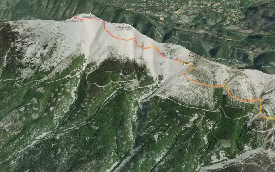
A camera drops in behind the route and flies the whole climb. Render it to video and send the crew a preview before you clip in.
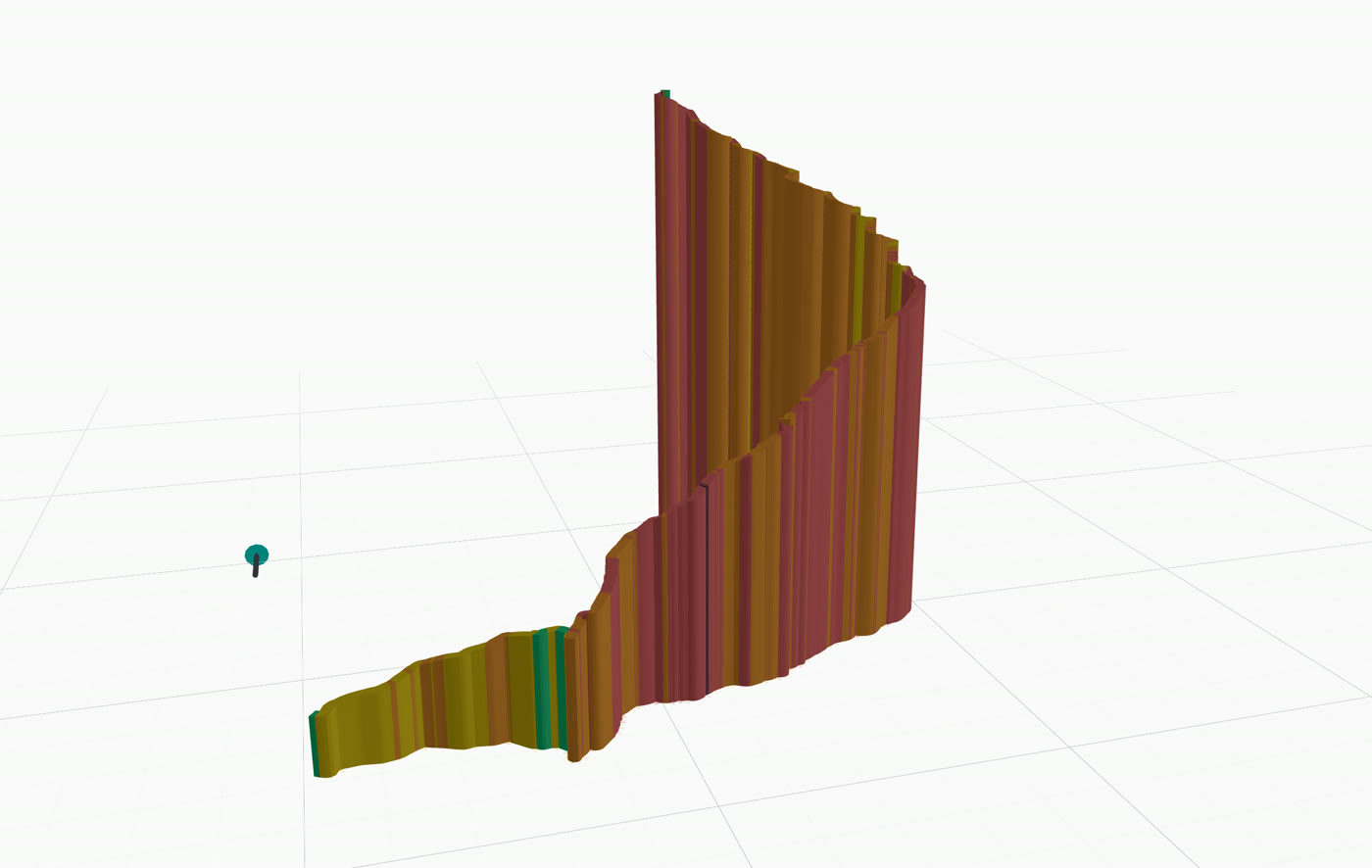
The same elevation profile, extruded into a ribbon you can rotate and read from any angle. Steeper ramps literally stand up off the page.
Plan the days that matter
For the rides you'll remember.
The cycling holidays you save up for. The events you sign up for in January and lose sleep over in May. Climbprofile reads them climb by climb, so you walk in already knowing the shape of the day.
For the Marmotte
Glandon, Télégraphe, Galibier, Alpe.
Every climb of the day in one tab. Know where the Galibier ends you, so the Alpe doesn't.
For Mallorca week
Sa Calobra, Soller, Lluc, repeat.
Plan every ride of camp before the deposit clears. Pick the days you save the legs and the days you spend them.
For the Dolomites trip
Tre Cime, Pordoi, Sella Ronda.
Five days, twelve climbs, one plan. Know what you signed up for before you board the plane.
For the local Gran Fondo
The one kicker that decides it.
Find the climb that actually splits the bunch. Pace the rest. Save the matches for the move.
Pricing
Less than a coffee. For the whole season.
One espresso at the top of the Stelvio costs more than a year of Hilly. We picked the prices on purpose. Pay yearly, save sixteen percent.
For trying it out
Free
See the shape of the day. Five routes, full climb detection.
For the weekend rider
Flat
Room for a full season. Enhanced stats, plus the community.
For the serious climber
Hilly
Every climb graded, read, and paced.
For coaches, clubs & creators
Mountain
Embed, export, white-label. Higher AI quotas.
Questions
The short answers.
Why not just use Strava or Komoot?
Strava and Komoot are great at recording rides and finding routes. Climbprofile is built for the planning side: before the ride, climb by climb. Drop a GPX, see every climb broken out, get a finish-time estimate at your power, then take that briefing into the ride. It complements the tools you already use rather than replacing them.
What file formats does Climbprofile accept?
GPX. If Strava, Komoot, Garmin Connect, Wahoo, or Ride with GPS can export it, Climbprofile can read it.
Does it work with my Strava routes?
Yes. Export the GPX from Strava and drop it in. Paid tiers can also connect a Strava account from Settings → Integrations and pull activities straight in.
Can I share a route with the crew?
Yes. Every saved route gets a shareable view link, so you can send the day's plan to your group chat before the trip.
Do I need an account to try it?
No. Drop a GPX on the Try page and you get elevation and climb detection in your browser. Saving routes and the AI features need an account.
What's free and what's paid?
Free gives you up to 5 saved routes with profiles and climb detection. Flat adds 20 routes, deeper stats, POI markers with photos, and the community. Hilly adds UCI categorisation, AI climb narration, the pacing simulator, and unlimited routes. Mountain is the creator tier: unwatermarked embeds, flyover MP4 exports, higher AI quotas.
What happens to my GPX files?
Signed-in uploads stay private in your account. The Try demo parses the file in your browser. Nothing leaves your device.
Is Climbprofile affiliated with Strava, Komoot, or Garmin?
No. It's an independent project that reads the GPX files those platforms export.
Free climb profiles
Legendary climbs, analysed for free.
Interactive profiles of Grand Tour giants, Monuments, and cobbled classics. No signup, no upload needed.
Built from the saddle
By a cyclist who needed it.
Climbprofile is the climb-by-climb briefing I wanted before every big day in the mountains and never found anywhere else. So I built it. Now you get it too.
That's the moat: it has to keep working for my own riding before it works for anyone else's. Every release ships only after I've taken it out on real climbs.
Your data is yours
GPX in, GPX out. Export every route — and every single climb — back to a file. No lock-in, no held-hostage data. If the lights ever go out you walk away with everything you uploaded.
Talk to the builder
Hit a rough edge or have a feature request? Email [email protected]. Goes straight to the person who built it.